The hotel was fully booked but I was still able to book a place to sleep in the shared room. This booking includes the trip to the Rothorn and breakfast as well as the trip to Brienz the next day. However, I didn't want to take advantage of this ride opportunity.
The day before the hike I took the train to Brienz and the connecting steam locomotive up to the Brienzer Rothorn at 16:38. The journey takes around an hour.
To my surprise, I was allocated a single room at reception instead of the shared room.
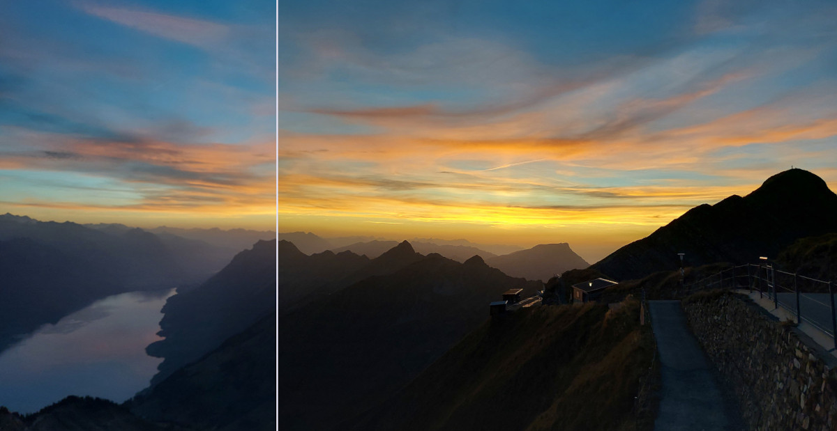
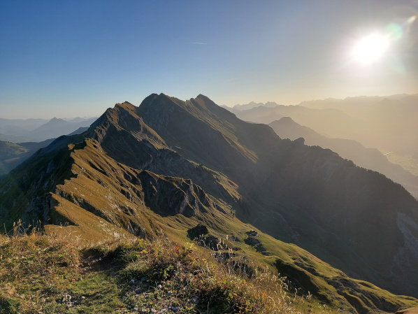
At 19:00 I was able to capture this beautiful sunset while having dinner.
 |
Unfortunately, I couldn't benefit from the single room as much as I expected, I slept pretty badly.
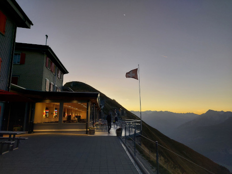
Because breakfast could officially only be taken from 8:00, I used the separate room with the modest breakfast.
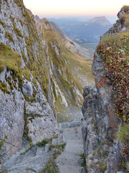
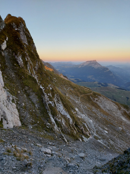
I started the hike just after daylight at 7:30. On the way to the Chrutere Pass you go down a flight of stairs after 20 minutes.
 |
 |
 |
After the stairs and a flat section I came to the Chrutere at 2073m.
The official hiking trail ends at Chrutere and you then descend to Brienz or Soerenberg.
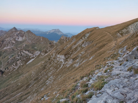
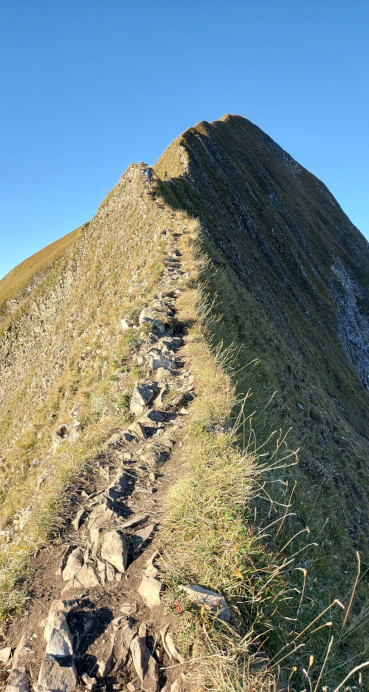
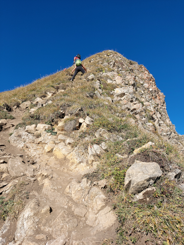
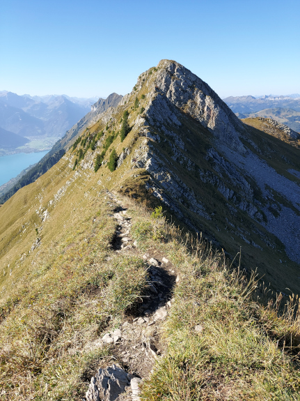
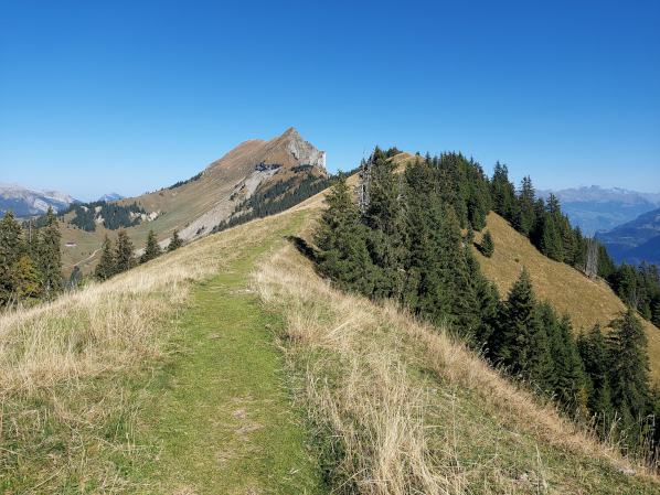
The actual ridge path starts here. A sign board at the mountain station advises against this ridge hike.
Left: Shortly after the stairs.
Right: Still before the ridge path, at 7:57.
 |
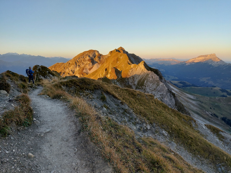 |
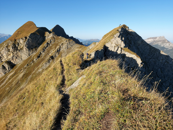
Left: At 8:08 a view of the first of what feels like 1000 spikes. I wasn't alone on the ridge, I had 2 hikers in front of me.
Right: First ridge feeling at 8:26
 |
 |
Because the spikes followed each other so quickly, I had to take photos every 10 minutes.
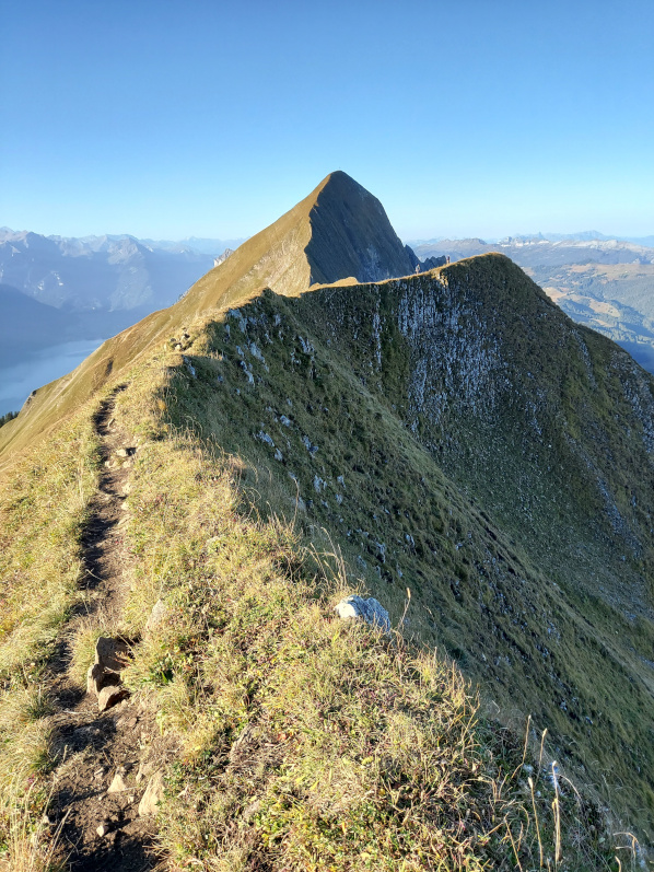
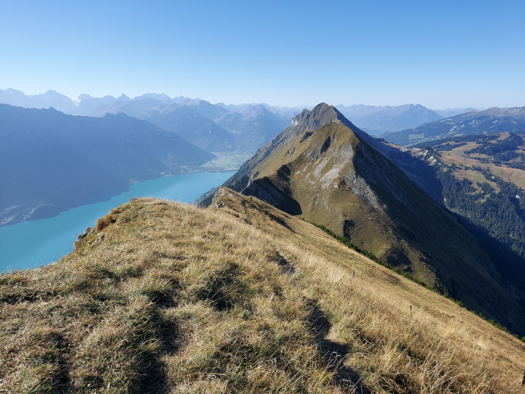
Left: After 1h10, view back to the Rothorn
Right: 10 minutes later what was directly in front of me.
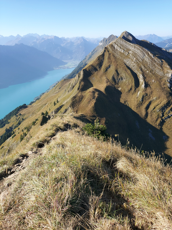
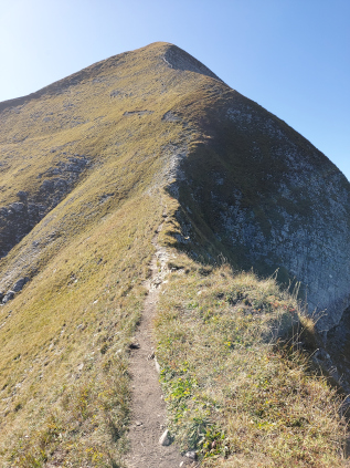
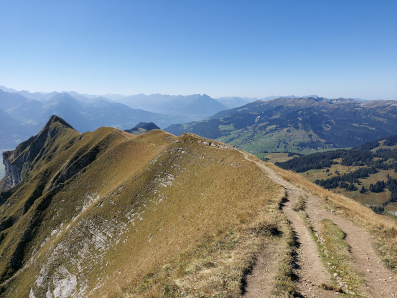
Finding the route was actually easy, you always have to stay on the ridge. Signaling is therefore unnecessary and the path is well-trodden.
 |
 |
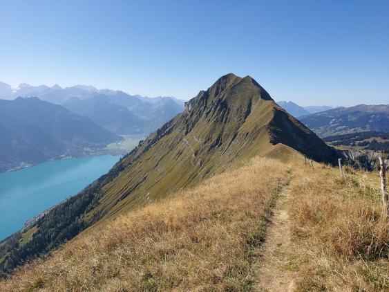
At 9:10 I had the Chrutere Pass, the Briefehoernli and the Wanne Pass and the descent option behind me.
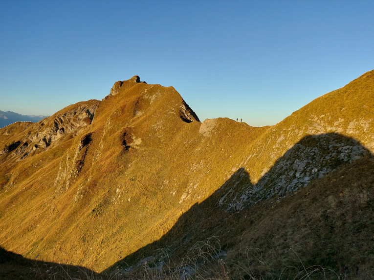
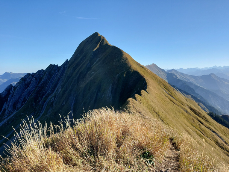
Left: On the ridge near Balmi at 9:10. In the background is the alleged key point T5 in front of the Tannhorn in the saddle.
Right: In my opinion, the key point in front of the Tannhorn is greatly defused with the rope. This is a walk compared to the ridge that follows. Of course, this is perceived differently from person to person.
 |
 |
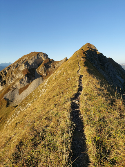
I don't have a photo of the named ridge because it meant exercising full concentration. I then used this and walked with small steps, but at least without hiking poles.
Left: Ascent to Tannhorn at 9:27. The cross is just visible.
Right: View from Tannhorn towards Rothorn at 9:50, after 2h20 and 5.2km.
 |
 |
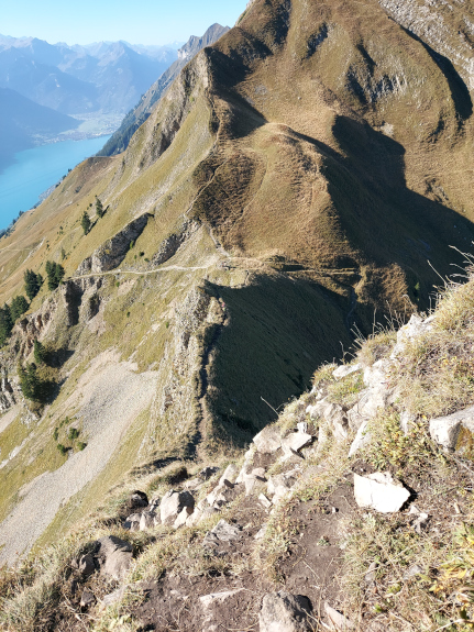
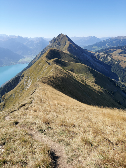
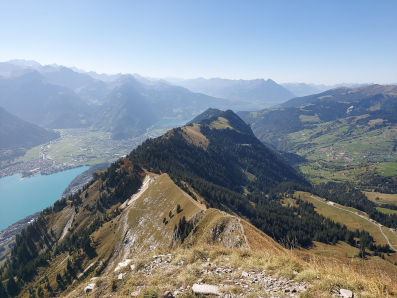
Left: View of the further points.
Right: The dominant Tannhorn, which is already behind me on this section, at 10:10. I only used the hiking poles just after the Tannhorn.
They didn't really help on the steep climbs and descents. I packed the pick for this, but didn't use it either. However, if the path is not completely dry, the pick can be valuable.
 |
 |
Left: Steep climb with partly rocky ground. Many of the stones are loose and need to be checked beforehand as a hold.
Right: 2 more spikes, the Schnierenhireli at 2070m and the Gummhoren at 2040m. Behind it is the Augstmatthorn.
 |
 |
Left: Steep, earthy descent to Allgeu Luecke. There you can descend to the left or right of the ridge.
Right: The climb to the Allgeu Luecke is just as steep. It's only 11:10, but it feels like 14:00.
 |
 |
Left: The Schnierenhireli.
Right: From Schnierenhireli towards Gummhoren.
 |
 |
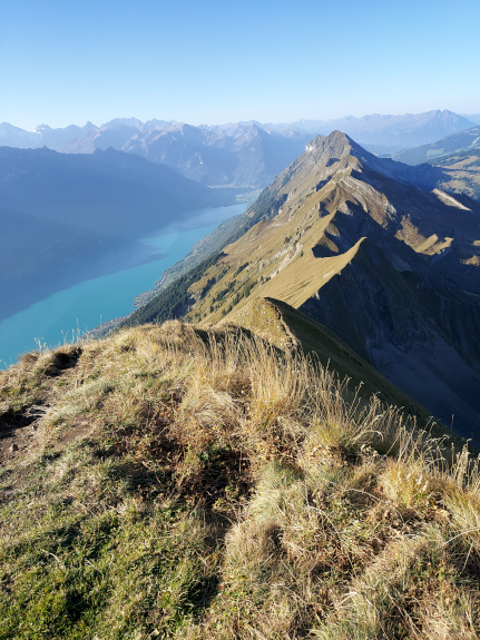
Left: At 12:00 on the Gummhoren with a view to Rothorn.
Right: View of Augstmatthorn.
 |
 |
Left: From the Blasenhubel view to Augstmatthorn. Before that comes the Wytlowihoren.
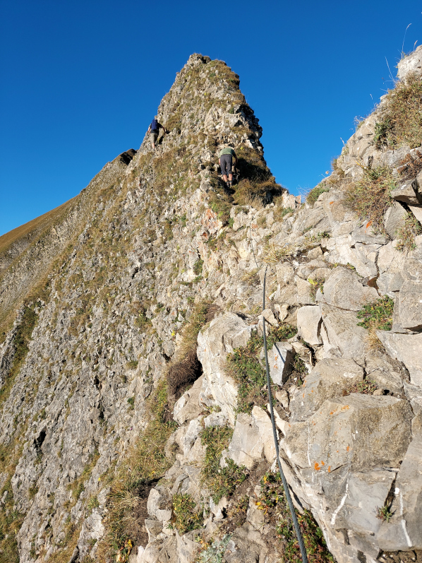
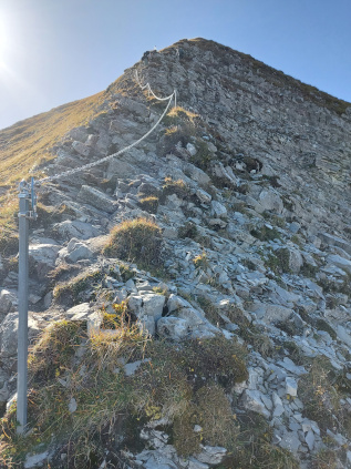
Middle and right: Ascent to the Augstmatthorn, secured with a chain because all types of hikers are expected here.
 |
 |
 |
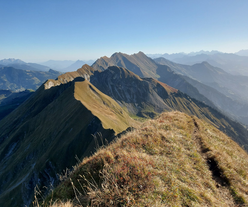
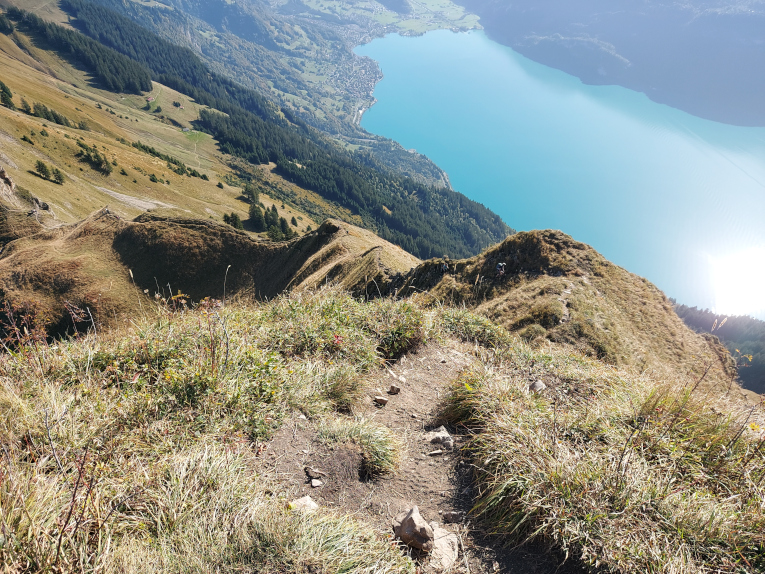
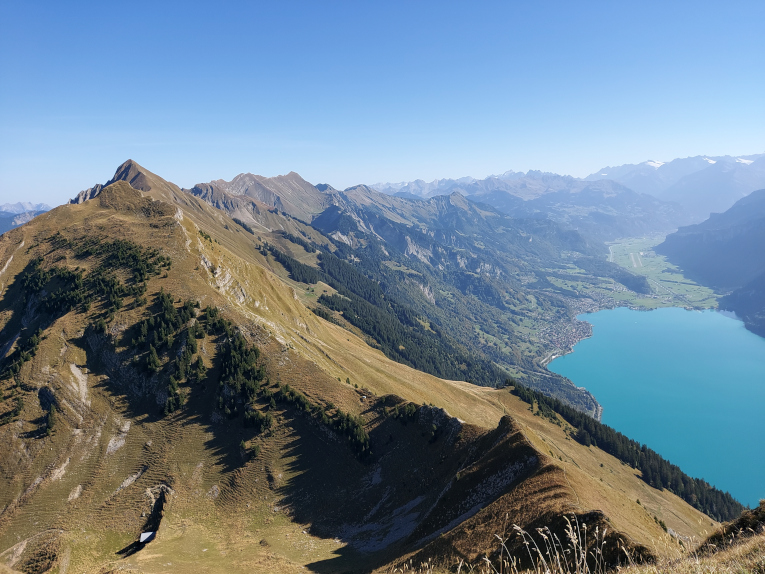
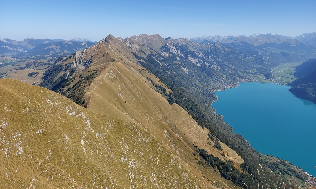
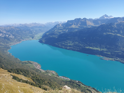
On the Augstmatthorn at 13:00 with a view towards Rothorn and Brienz at the lake.
It is easy to see that the ridge gradually becomes wider.
After 5h30 of hiking, I'm not even halfway through the route. But at least the slow part of the ridge.
 |
Middle: View towards Suggiture, the last point on the ridge walk.
Right: After the Suggiture there is a short stretch above the tree line to Roteflue.
The destination was even further away than perceived, namely at 1h30.
 |
 |
 |
Left: At Horetegg at 14:05.
Right: Looking back at the Suggiture.
 |
 |
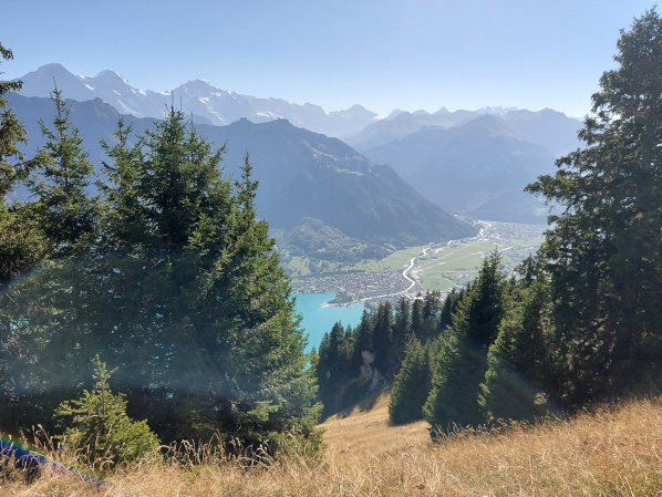
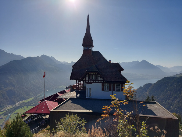
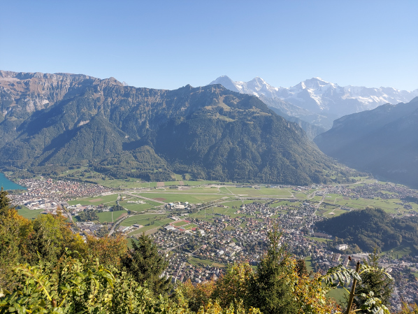
At 15:30 I reached the Harder Kulm, which is considered Interlaken's local mountain.
Because Harder Kulm can be reached by train, spending time on the terrace isn't fun, even though you like the view.
 |
 |
After the Harder Kulm the idea was to take the steep descent via Schiebeflue. I missed it and took a short detour via St. Niklausen.
At 17:00 or after 9h30 hiking, including the practically non-existent breaks, I reached B.
After showering, there was nothing to put away and I went shopping in hiking gear for dinner, at least without ice axes and hiking poles.
I started with 7.5kg on my back and am now 2L of water, a few drops of sweat and many bars lighter.
As expected, the distance and the descent didn't cause any muscle soreness.
However, the constant scrambling in the T3-T4 area should not be underestimated.
 |
 |